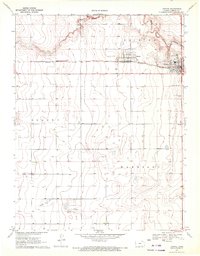
1970 Map of Tribune
USGS Topo · Published 1972About this map
Tribune and the adjacent settlement of Horace serve as the primary hubs of activity in this High Plains region, centered along the east-west corridor of the Missouri Pacific railroad. The landscape is defined by vast agrarian sections under the jurisdictions of Tribune, Colony, and Harrison townships. Water is a scarce and defining resource here, with the ephemeral White Woman Creek carving a winding path across the northern reaches of the quadrangle. Local infrastructure is concentrated around the town sites, including the Fairground and the Tribune Municipal Airport. Genealogists may find particular value in the location of the Greeley County Cem, situated north of the airport. The map reflects a period of established agricultural stabilization in Western Kansas, where the rectilinear grid of section lines and state routes like 96 and 27 dictate the movement of goods and people.
Find a feature on this map
12 named features on this map. Tap any name to fly to it.
Don’t see what you’re looking for? This feature index may not catch every label — zoom into the map to look around manually.
Map Details
Editions of this 1970 Tribune Map
This is the sole edition of this map. No revisions or reprints were ever made.
Other maps of this area

1955 · Scott City
USGS Topo · 1:250,000

1958 · Scott City
USGS Topo · 1:250,000

1970 · Selkirk SW
USGS Topo · 1:24,000

1970 · Sharon Springs 3 SE
USGS Topo · 1:24,000

1970 · Sharon Springs 4 SW
USGS Topo · 1:24,000
1970 · Sharon Springs 3 SW
USGS Topo · 1:24,000

1970 · Selkirk NW
USGS Topo · 1:24,000
1970 · Tribune NW
USGS Topo · 1:24,000

1970 · Tribune SE
USGS Topo · 1:24,000
1970 · Tribune SW
USGS Topo · 1:24,000