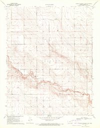
1970 Map of Sharon Springs 3 SW
USGS Topo · Published 1972About this map
White Woman Creek cuts through the High Plains landscape of Western Kansas, defining the local topography as it winds through Greeley and Wallace counties. In the early 1970s, this area remained largely open rangeland and agricultural territory, marked by the prominent elevated terrain of Colony. Human activity is primarily industrial and utilitarian, evidenced by the presence of a Gravel Pit, Sandpit, and a Drill Hole, reflecting the region's extraction and geological exploration. Transport across this sparse landscape is facilitated by a Landing Strip and a network of unimproved roads including a Jeep Trail. Scattered wells indicate the critical importance of groundwater management in this arid environment, where surface water features like the creek are central to the settlement and land-use patterns of the era.
Find a feature on this map
9 named features on this map. Tap any name to fly to it.
Don’t see what you’re looking for? This feature index may not catch every label — zoom into the map to look around manually.
Map Details
Editions of this 1970 Sharon Springs 3 SW Map
2 editions found
Other maps of this area

1890 · Granada
USGS Topo · 1:125,000

1892 · Cheyenne Wells
USGS Topo · 1:125,000

1892 · Granada
USGS Topo · 1:125,000

1894 · Cheyenne Wells
USGS Topo · 1:125,000

1894 · Granada
USGS Topo · 1:125,000

1954 · Lamar
USGS Topo · 1:250,000

1955 · Scott City
USGS Topo · 1:250,000

1958 · Lamar
USGS Topo · 1:250,000

1958 · Scott City
USGS Topo · 1:250,000

1968 · Sharon Springs 3 NE
USGS Topo · 1:24,000