
1970 Map of Sharon Springs 4 SW
USGS Topo · Published 1971About this map
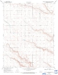
Tribune and the surrounding high plains of western Kansas are defined by a sparse, grid-like settlement pattern in this 1970 field-checked survey. The landscape is characterized by its agricultural utility and resource extraction, with numerous instances of a Well or Gas Well peppered across the townships. The terrain transition between T. 16 S. and T. 17 S. reveals the subtle topographic shifts of the region, while evidence of local industry appears at the Gravel Pit near the boundary of Range 40 West and Range 39 West. This map captures the area just before significant modern irrigation and industrial shifts further altered the High Plains water table and land use.
Find a feature on this map
8 named features on this map. Tap any name to fly to it.
Don’t see what you’re looking for? This feature index may not catch every label — zoom into the map to look around manually.
Map Details
Editions of this 1970 Sharon Springs 4 SW Map
2 editions found
Other maps of this area

1955 · Scott City
USGS Topo · 1:250,000

1958 · Scott City
USGS Topo · 1:250,000

1968 · Sharon Springs 3 NE
USGS Topo · 1:24,000

1968 · Sharon Springs 4 NW
USGS Topo · 1:24,000

1968 · Sharon Springs 4 NE
USGS Topo · 1:24,000

1970 · Sharon Springs 4 SE
USGS Topo · 1:24,000

1970 · Sharon Springs 3 SE
USGS Topo · 1:24,000

1970 · Selkirk
USGS Topo · 1:24,000

1970 · Selkirk NW
USGS Topo · 1:24,000
1970 · Tribune
USGS Topo · 1:24,000