
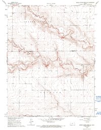
1968 Map of Sharon Springs 4 NW
USGS Topo · Published 1969About this map
The high plains of the High Plains region along the Wallace Co Greeley Co border are defined by the intricate drainage systems of Ladder Creek. This 1968 survey details the convergence of several major tributaries, including Middle Ladder Creek, South Ladder Creek, and Sharon Springs Creek, which carve distinct paths through the surrounding South Flats. The landscape is a study in early Western Kansas land management, marked by numerous wells and extensive fence and field lines captured during 1966 aerial photography.
Find a feature on this map
10 named features on this map. Tap any name to fly to it.
Don’t see what you’re looking for? This feature index may not catch every label — zoom into the map to look around manually.
Map Details
Editions of this 1968 Sharon Springs 4 NW Map
2 editions found
Other maps of this area

1955 · Scott City
USGS Topo · 1:250,000

1958 · Scott City
USGS Topo · 1:250,000

1959 · Weskan
USGS Topo · 1:62,500

1959 · Wallace
USGS Topo · 1:62,500

1968 · Sharon Springs 3 NE
USGS Topo · 1:24,000

1968 · Sharon Springs 4 NE
USGS Topo · 1:24,000

1970 · Sharon Springs 4 SE
USGS Topo · 1:24,000

1970 · Sharon Springs 3 SE
USGS Topo · 1:24,000

1970 · Sharon Springs 4 SW
USGS Topo · 1:24,000
1979 · Spring Valley Ranch
USGS Topo · 1:24,000
Featured Places
- Sharon Springs Township, KS
- Tribune Township, KS
- Harrison Township, KS
- Greeley County, KS
- Wallace County, KS