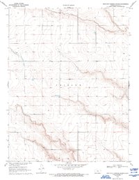
1970 Map of West of St. Theresa Church
USGS Topo · Published 1993About this map
High plains terrain defines this 1970 survey of Greeley County, dominated by the expansive boundary of Tribune which spans the central portion of the sheet. The landscape is marked by a network of intermittent stream beds and drainage patterns characteristic of western Kansas, where water management and resource extraction are primary features. Land use is reflected in localized industrial markers such as the Gravel Pit located in the southern sections, and evidence of energy exploration is seen in the presence of a Gas Well. The topography is precisely rendered by the U.S. Geological Survey in cooperation with Kansas state agencies, documenting the section lines and rural infrastructure of the era.
Find a feature on this map
3 named features on this map. Tap any name to fly to it.
Don’t see what you’re looking for? This feature index may not catch every label — zoom into the map to look around manually.
Map Details
Editions of this 1970 West of St. Theresa Church Map
2 editions found
Other maps of this area

1955 · Scott City
USGS Topo · 1:250,000

1958 · Scott City
USGS Topo · 1:250,000

1968 · Sharon Springs 3 NE
USGS Topo · 1:24,000

1968 · Sharon Springs 4 NW
USGS Topo · 1:24,000

1968 · Sharon Springs 4 NE
USGS Topo · 1:24,000

1970 · Sharon Springs 4 SE
USGS Topo · 1:24,000

1970 · Sharon Springs 3 SE
USGS Topo · 1:24,000

1970 · Sharon Springs 4 SW
USGS Topo · 1:24,000

1970 · Selkirk
USGS Topo · 1:24,000

1970 · Selkirk NW
USGS Topo · 1:24,000