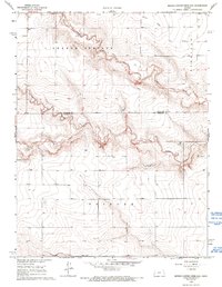
1968 Map of Middle Ladder Creek East
USGS Topo · Published 1993About this map
Middle Ladder Creek and South Ladder Creek carve through the high plains of western Kansas, defining a landscape of deeply incised drainage systems and flat uplands. This 1968 field-checked survey reveals the transition from the open expanses of South Flats into the broken ground of the creek valleys. The map documents the rural character of the border between Wallace and Greeley Counties, where the townships of Sharon Springs, Harrison, and Tribune meet. Human presence is sparse but clearly marked by a network of unimproved roads and scattered water infrastructure. A notable point of local history is recorded at Bethany Cem, situated near the confluence of the creek branches, serving as a primary genealogical landmark for the surrounding ranching and farming community.
Find a feature on this map
9 named features on this map. Tap any name to fly to it.
Don’t see what you’re looking for? This feature index may not catch every label — zoom into the map to look around manually.
Map Details
Editions of this 1968 Middle Ladder Creek East Map
2 editions found
Other maps of this area

1955 · Scott City
USGS Topo · 1:250,000

1958 · Scott City
USGS Topo · 1:250,000

1959 · Weskan
USGS Topo · 1:62,500

1959 · Wallace
USGS Topo · 1:62,500

1968 · Sharon Springs 3 NE
USGS Topo · 1:24,000

1968 · Sharon Springs 4 NW
USGS Topo · 1:24,000

1968 · Sharon Springs 4 NE
USGS Topo · 1:24,000

1970 · Sharon Springs 4 SE
USGS Topo · 1:24,000

1970 · Sharon Springs 3 SE
USGS Topo · 1:24,000

1970 · Sharon Springs 4 SW
USGS Topo · 1:24,000
Featured Places
- Sharon Springs Township, KS
- Tribune Township, KS
- Harrison Township, KS
- Greeley County, KS
- Wallace County, KS