
1970 Map of Selkirk SW
USGS Topo · Published 1971About this map
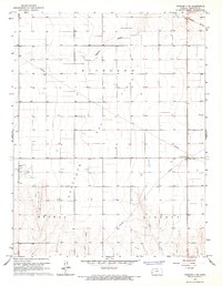
Harrison and Richland townships characterize this high plains landscape on the western edge of Kansas during the late 1960s. The survey reveals a highly structured environment defined by the Public Land Survey System, where section lines dictate the placement of roads and property boundaries across the open terrain. Significant for its documentation of administrative geography, the map clearly delineates the border between Greeley Co and Hamilton Co. While the map is sparse in named settlements, the intricate contour lines and scattered windmills illustrate the region's reliance on groundwater management and extensive land use. This specific edition captures the rural layout of the High Plains before modern industrial shifts, serving as a primary source for understanding the spatial organization of the Kansas borderlands.
Find a feature on this map
3 named features on this map. Tap any name to fly to it.
Don’t see what you’re looking for? This feature index may not catch every label — zoom into the map to look around manually.
Map Details
Editions of this 1970 Selkirk SW Map
This is the sole edition of this map. No revisions or reprints were ever made.
Other maps of this area

1955 · Scott City
USGS Topo · 1:250,000

1958 · Scott City
USGS Topo · 1:250,000

1966 · Tribune 4 NW
USGS Topo · 1:24,000
1966 · Tribune 3 NE
USGS Topo · 1:24,000

1966 · Tribune 4 NE
USGS Topo · 1:24,000

1970 · Selkirk SE
USGS Topo · 1:24,000

1970 · Selkirk
USGS Topo · 1:24,000

1970 · Selkirk NW
USGS Topo · 1:24,000

1970 · Tribune SE
USGS Topo · 1:24,000
1970 · Tribune
USGS Topo · 1:24,000