1970 Map of Sharon Springs 3 SE
USGS Topo · Published 1971About this map
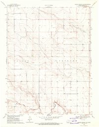
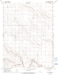
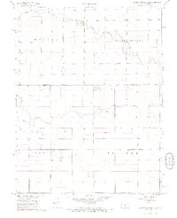
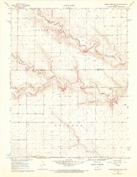
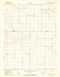
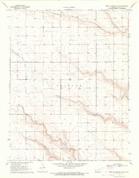
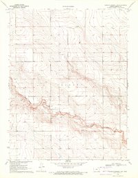
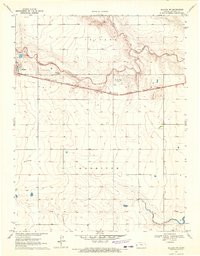
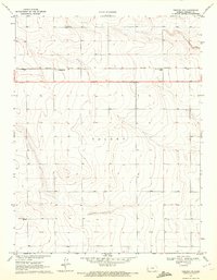
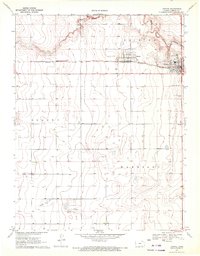
White Woman Creek meanders across the southern portion of this High Plains landscape in Greeley County, defining the drainage patterns of the western Kansas steppe. The 1970 field check reveals a largely rural expanse divided into the townships of Colony and Tribune, where the land is organized by the Public Land Survey System into a grid of sections. Resource extraction and local infrastructure are marked by several wells and a series of industrial sites along the creek bed, including a Sandpit and a Gravel Pit. These features, along with the numerous elevation benchmarks and small bridges like BR 3698, reflect a landscape managed for agriculture and local transit at the start of the 1970s. The topographic detail captures the subtle drainage draws and ridges that characterize this part of the state before modern large-scale center-pivot irrigation became ubiquitous.
Find a feature on this map
11 named features on this map. Tap any name to fly to it.
Don’t see what you’re looking for? This feature index may not catch every label — zoom into the map to look around manually.
Map Details
Editions of this 1970 Sharon Springs 3 SE Map
2 editions found
Other maps of this area

1955 · Scott City
USGS Topo · 1:250,000

1958 · Scott City
USGS Topo · 1:250,000
1968 · Sharon Springs 3 NE
USGS Topo · 1:24,000
1968 · Sharon Springs 4 NW
USGS Topo · 1:24,000
1968 · Sharon Springs 3 NW
USGS Topo · 1:24,000
1970 · Sharon Springs 4 SW
USGS Topo · 1:24,000
1970 · Sharon Springs 3 SW
USGS Topo · 1:24,000
1970 · Selkirk NW
USGS Topo · 1:24,000
1970 · Tribune NW
USGS Topo · 1:24,000
1970 · Tribune
USGS Topo · 1:24,000