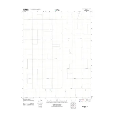
2012 Map of Selkirk SW
USGS Topo · Published 2012About this map
Tribune Township in the high plains of western Kansas is defined by a rigid section-line road network that segments the Greeley County landscape into vast agricultural blocks. This early 21st-century survey illustrates the geometry of rural life, where long north-south corridors like Co Rd-17, Co Rd-18, and Co Rd-20 intersect with east-west thoroughfares such as Co Road X and Co Road DD. The sparse naming convention of the road system—utilizing both alphabetical and numerical identifiers—reflects the systematic organization of the Land Ordinance survey system in a region where the terrain and settlement patterns are dictated by the demands of large-scale farming and dryland agriculture. The absence of named settlements or water bodies within this quadrangle emphasizes the open, rural character of the High Plains near the Colorado border.
Find a feature on this map
20 named features on this map. Tap any name to fly to it.
Don’t see what you’re looking for? This feature index may not catch every label — zoom into the map to look around manually.
Map Details
Editions of this 2012 Selkirk SW Map
This is the sole edition of this map. No revisions or reprints were ever made.
Other maps of this area

1955 · Scott City
USGS Topo · 1:250,000

1958 · Scott City
USGS Topo · 1:250,000

1966 · Tribune 4 NW
USGS Topo · 1:24,000
1966 · Tribune 3 NE
USGS Topo · 1:24,000

1966 · Tribune 4 NE
USGS Topo · 1:24,000

1970 · Selkirk SW
USGS Topo · 1:24,000

1970 · Selkirk SE
USGS Topo · 1:24,000

1970 · Selkirk
USGS Topo · 1:24,000

1970 · Selkirk NW
USGS Topo · 1:24,000

1970 · Tribune SE
USGS Topo · 1:24,000