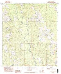
1982 Map of Sellers
USGS Topo · Published 1983About this map
The Wolf River winds through the heart of this coastal Mississippi landscape, defining the boundary between Hancock and Harrison counties. In the early 1980s, this area remained largely rural, characterized by a network of creek systems including Crane Creek, Bell Creek, and Sandy Creek. Small communities such as Riceville and Sellers are connected by local routes like Mc Henry Road and Riceville Road, while the southern reaches feature the settlement of Dedeaux and the Salmon Scout Reservation.
Find a feature on this map
31 named features on this map. Tap any name to fly to it.
Don’t see what you’re looking for? This feature index may not catch every label — zoom into the map to look around manually.
Map Details
Editions of this 1982 Sellers Map
2 editions found
Other maps of this area

1953 · Mobile
USGS Topo · 1:250,000

1954 · McHenry
USGS Topo · 1:62,500

1955 · Savannah
USGS Topo · 1:62,500

1956 · Vidalia
USGS Topo · 1:24,000

1956 · Gulfport NW
USGS Topo · 1:24,000

1957 · Mobile
USGS Topo · 1:250,000
1959 · Kiln
USGS Topo · 1:24,000

1960 · Mobile
USGS Topo · 1:250,000

1963 · Mobile
USGS Topo · 1:250,000

1965 · Mobile
USGS Topo · 1:250,000