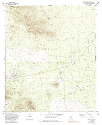
1979 Map of Sells East
USGS Topo · Published 1985About this map
The Papago Indian Reservation landscape is defined by the transition from the South Comobabi Mountains to the broad alluvial plains of Sells Valley and Baboquivari Valley. This late 1970s survey captures the regional administrative hub at Sells, where essential infrastructure like Baboquivari High School and various water tanks supported the Tohono O'odham community. The importance of desert water management is evident through numerous named sources such as Presbyterian Well and Rattlesnake Well, which sustained life in this arid environment.
Find a feature on this map
30 named features on this map. Tap any name to fly to it.
Don’t see what you’re looking for? This feature index may not catch every label — zoom into the map to look around manually.
Map Details
Editions of this 1979 Sells East Map
2 editions found
Other maps of this area

1934 · Silver Bell
USGS Topo · 1:125,000

1937 · Comobabi
USGS Topo · 1:48,000

1938 · San Vicente
USGS Topo · 1:62,500

1941 · San Vicente
USGS Topo · 1:62,500

1941 · Baboquivari Peak
USGS Topo · 1:62,500

1941 · Sells
USGS Topo · 1:62,500

1942 · San Vicente
USGS Topo · 1:62,500

1942 · Comobabi
USGS Topo · 1:62,500

1943 · Sells
USGS Topo · 1:62,500

1943 · Fresnal
USGS Topo · 1:125,000