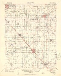
1946 Map of Selma
USGS Topo · Published 1954About this map
Agricultural development and a burgeoning irrigation network define this region of the Central Valley just after World War II. The landscape is meticulously partitioned by countless ditches and canals feeding into orchards and vineyards, anchored by the Kings River along the eastern edge. Major rail arteries of the Southern Pacific and the Atchison Topeka and Santa Fe serve as the backbone for local commerce, connecting the industrial fringes of Fresno with established farming hubs like Selma, Sanger, and Kingsburg. Genealogists will find a wealth of local landmarks, from rural schoolhouses like Terry School and Locans Sch to the Swedish Mission and various denominational landmarks like Bethel Ch. This era marks a peak in the small-farm grid before the consolidation of the late 20th century, capturing the precise locations of the U S Experimental Station and numerous family-named landmarks including Wineland and Conejo.
Find a feature on this map
73 named features on this map. Tap any name to fly to it.
Don’t see what you’re looking for? This feature index may not catch every label — zoom into the map to look around manually.
Map Details
Editions of this 1946 Selma Map
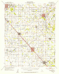
2 editions found
Other maps of this area

1920 · Orangedale School
USGS Topo · 1:24,000

1921 · Bullard
USGS Topo · 1:31,680

1922 · Round Mountain
USGS Topo · 1:31,680

1922 · Trimmer
USGS Topo · 1:96,000

1923 · Malaga
USGS Topo · 1:31,680

1923 · Orangedale School
USGS Topo · 1:31,680

1923 · Fresno
USGS Topo · 1:31,680

1923 · Clovis
USGS Topo · 1:31,680

1923 · Wahtoke
USGS Topo · 1:31,680

1923 · Sanger
USGS Topo · 1:31,680