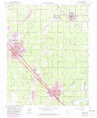
1964 Map of Selma
USGS Topo · Published 1981About this map
Agricultural development and industrial growth define this Central Valley landscape, centered on the bustling municipalities of Selma and Kingsburg. The map reveals a dense network of irrigation canals and drainage systems, such as the Kingsburg Branch and Ward Drainage Ditch, which support the vast orchard and vineyard lands of the San Joaquin Valley. The industrial corridor is anchored by the Southern Pacific and the Atchison Topeka and Santa Fe railroads, which facilitated the movement of goods from local packing houses.
Find a feature on this map
48 named features on this map. Tap any name to fly to it.
Don’t see what you’re looking for? This feature index may not catch every label — zoom into the map to look around manually.
Map Details
Editions of this 1964 Selma Map
2 editions found
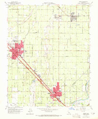
Other maps of this area

1922 · Trimmer
USGS Topo · 1:96,000

1923 · Malaga
USGS Topo · 1:31,680

1923 · Wahtoke
USGS Topo · 1:31,680

1923 · Sanger
USGS Topo · 1:31,680

1924 · Reedley
USGS Topo · 1:31,680

1924 · Selma
USGS Topo · 1:31,680

1924 · Conejo
USGS Topo · 1:31,680

1924 · Dinuba
USGS Topo · 1:125,000

1926 · Burris Park
USGS Topo · 1:31,680

1927 · Traver
USGS Topo · 1:31,680