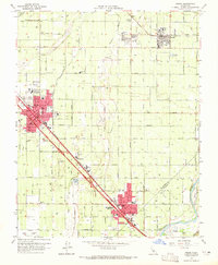
1964 Map of Selma
USGS Topo · Published 1965About this map
Selma and Kingsburg anchor this mid-1960s landscape, serving as hubs for the intensive irrigation network of the San Joaquin Valley. The dominance of the Southern Pacific and Atchison Topeka and Santa Fe railroads illustrates the vital transportation corridors that connected these agricultural centers to broader markets. Between these towns, the small settlement of Wineland sits along the rail line, surrounded by a dense grid of named roads like Nebraska Ave and Rose Avenue.
Find a feature on this map
53 named features on this map. Tap any name to fly to it.
Don’t see what you’re looking for? This feature index may not catch every label — zoom into the map to look around manually.
Map Details
Editions of this 1964 Selma Map
2 editions found
Other maps of this area

1922 · Trimmer
USGS Topo · 1:96,000

1923 · Malaga
USGS Topo · 1:31,680

1923 · Wahtoke
USGS Topo · 1:31,680

1923 · Sanger
USGS Topo · 1:31,680

1924 · Reedley
USGS Topo · 1:31,680

1924 · Selma
USGS Topo · 1:31,680

1924 · Conejo
USGS Topo · 1:31,680

1924 · Dinuba
USGS Topo · 1:125,000

1926 · Burris Park
USGS Topo · 1:31,680

1927 · Traver
USGS Topo · 1:31,680