1947 Map of Selma
USGS Topo · Published 1947About this map
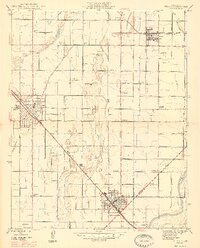
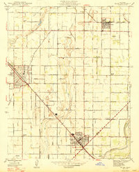
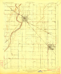
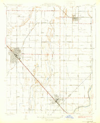
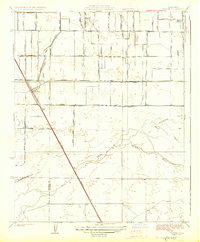
Selma and Kingsburg anchor this San Joaquin Valley landscape shortly after the Second World War, revealing a dense grid of agricultural infrastructure. The territory is defined by a complex irrigation network of ditches and canals, such as Mc Call Ditch and Kirby Ditch, which support the intensive cultivation around these growing railroad towns. The influence of the Southern Pacific and the Atchison Topeka and Santa Fe railroads is evident, dictating the orientation of the principal settlements. Local heritage is captured through specific landmarks like the Danish Ch and Swedish Mission, alongside numerous rural schoolhouses including Franklin Sch and Clay Sch. In the southeast, the Kings River marks the natural boundary between Fresno and Tulare counties, while early aviation is noted at the Paiva Intercity Landing Field.
Find a feature on this map
60 named features on this map. Tap any name to fly to it.
Don’t see what you’re looking for? This feature index may not catch every label — zoom into the map to look around manually.
Map Details
Editions of this 1947 Selma Map
2 editions found
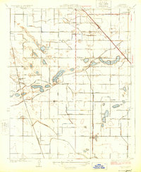
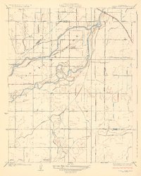
Other maps of this area

1922 · Trimmer
USGS Topo · 1:96,000

1923 · Malaga
USGS Topo · 1:31,680
1923 · Wahtoke
USGS Topo · 1:31,680
1923 · Sanger
USGS Topo · 1:31,680
1924 · Reedley
USGS Topo · 1:31,680
1924 · Selma
USGS Topo · 1:31,680
1924 · Conejo
USGS Topo · 1:31,680

1924 · Dinuba
USGS Topo · 1:125,000
1926 · Burris Park
USGS Topo · 1:31,680
1927 · Traver
USGS Topo · 1:31,680