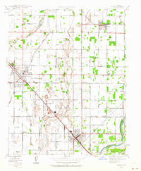
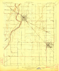
1946 Map of Selma
USGS Topo · Published 1964About this map
The agricultural heart of the San Joaquin Valley is defined by a dense network of irrigation channels and railroads connecting the regional hubs of Selma and Kingsburg. This 1946 culture revision highlights a landscape transitioning from early 20th-century rural settlement to mid-century industrial farming, supported by the Southern Pacific and the Atchison Topeka and Santa Fe railroads. Local community life is anchored by family and community institutions such as Franklin Sch, Walnut Sch, and the Danish Ch, reflecting the heritage of the settlers who established these vineyard and orchard lands. The importance of early aviation in this flat terrain is marked by the Paiva Intercity Landing Field and Selma Landing Field. To the southeast, the Kings River and Cole Slough provide a natural boundary, their winding paths contrasting with the rigid grid of rural avenues like Manning and Dinuba Avenue.
Find a feature on this map
49 named features on this map. Tap any name to fly to it.
Don’t see what you’re looking for? This feature index may not catch every label — zoom into the map to look around manually.
Map Details
Editions of this 1946 Selma Map
2 editions found
Other maps of this area

1922 · Trimmer
USGS Topo · 1:96,000

1923 · Malaga
USGS Topo · 1:31,680
1923 · Wahtoke
USGS Topo · 1:31,680
1923 · Sanger
USGS Topo · 1:31,680
1924 · Reedley
USGS Topo · 1:31,680
1924 · Selma
USGS Topo · 1:31,680
1924 · Conejo
USGS Topo · 1:31,680

1924 · Dinuba
USGS Topo · 1:125,000
1926 · Burris Park
USGS Topo · 1:31,680
1927 · Traver
USGS Topo · 1:31,680