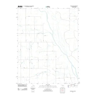
2012 Map of Selman NW
USGS Topo · Published 2012About this map
The Cimarron River carves a winding path through the northern plains of Harper County in this 2012 survey, defining the agrarian landscape of the Oklahoma-Kansas borderlands. The terrain is structured by a geometric grid of rural routes such as e0020 RD and n1980 RD, reflecting the persistent township and range settlement patterns of the region. Local history and genealogy are anchored by the Lutheran Cem in the southwest, a quiet marker of the community's heritage amidst the surrounding ranch and farmland. Drainage across the quadrangle is managed by several significant watercourses, including Lodge Pole Cr and Anderson Cr, which feed toward the main river valley. Small impoundments like Miller Lake provide localized water sources in this dry prairie environment, while the extensive road network indicates the ongoing importance of regional transport for the area's agricultural economy.
Find a feature on this map
23 named features on this map. Tap any name to fly to it.
Don’t see what you’re looking for? This feature index may not catch every label — zoom into the map to look around manually.
Map Details
Editions of this 2012 Selman NW Map
This is the sole edition of this map. No revisions or reprints were ever made.
Other maps of this area

1892 · Coldwater
USGS Topo · 1:125,000

1894 · Sitka
USGS Topo · 1:62,500

1896 · Ashland
USGS Topo · 1:125,000

1955 · Woodward
USGS Topo · 1:250,000

1955 · Pratt
USGS Topo · 1:250,000

1958 · Woodward
USGS Topo · 1:250,000

1959 · Pratt
USGS Topo · 1:250,000

1970 · Lookout
USGS Topo · 1:24,000

1970 · Buffalo SE
USGS Topo · 1:24,000

1970 · Selman NW
USGS Topo · 1:24,000