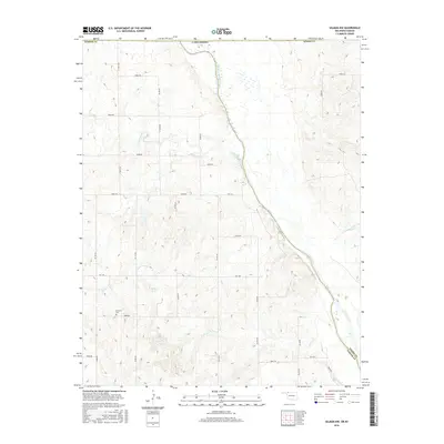
2016 Map of Selman NW
USGS Topo · Published 2016About this map
The Cimarron River winds through the northwestern corner of the Oklahoma Panhandle, carving a path across the border of Harper County and Woods County. This portion of the High Plains is defined by its drainage systems, including the serpentine course of Lodge Pole Creek and the smaller Anderson Creek. Human settlement in this rural landscape is sparse, anchored by a network of sectional roads and the historic Lutheran Cem, which serves as a significant genealogical marker for early families in the region. The map captures the agricultural and ranching character of the land, where natural features like Miller Lake stand out against the surveyed grid of rural routes such as Osage Rd.
Find a feature on this map
40 named features on this map. Tap any name to fly to it.
Don’t see what you’re looking for? This feature index may not catch every label — zoom into the map to look around manually.
Map Details
Editions of this 2016 Selman NW Map
This is the sole edition of this map. No revisions or reprints were ever made.
Other maps of this area

1892 · Coldwater
USGS Topo · 1:125,000

1894 · Sitka
USGS Topo · 1:62,500

1896 · Ashland
USGS Topo · 1:125,000

1955 · Woodward
USGS Topo · 1:250,000

1955 · Pratt
USGS Topo · 1:250,000

1958 · Woodward
USGS Topo · 1:250,000

1959 · Pratt
USGS Topo · 1:250,000

1970 · Lookout
USGS Topo · 1:24,000

1970 · Buffalo SE
USGS Topo · 1:24,000

1970 · Selman NW
USGS Topo · 1:24,000