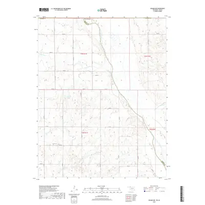
2018 Map of Selman NW
USGS Topo · Published 2018About this map
The Cimarron River carves a broad valley through the high plains along the Harper and Woods county line in this western Oklahoma landscape. The area is defined by its rural section-line grid, where roads like NS 198th Rd and E0080 Rd navigate a terrain of draws and breaks leading toward the river. At the heart of this ranching and farming country stands the Lutheran Cem, a quiet marker of the community's ancestral roots near the western edge of the survey.
Find a feature on this map
42 named features on this map. Tap any name to fly to it.
Don’t see what you’re looking for? This feature index may not catch every label — zoom into the map to look around manually.
Map Details
Editions of this 2018 Selman NW Map
This is the sole edition of this map. No revisions or reprints were ever made.
Other maps of this area

1892 · Coldwater
USGS Topo · 1:125,000

1894 · Sitka
USGS Topo · 1:62,500

1896 · Ashland
USGS Topo · 1:125,000

1955 · Woodward
USGS Topo · 1:250,000

1955 · Pratt
USGS Topo · 1:250,000

1958 · Woodward
USGS Topo · 1:250,000

1959 · Pratt
USGS Topo · 1:250,000

1970 · Lookout
USGS Topo · 1:24,000

1970 · Buffalo SE
USGS Topo · 1:24,000

1970 · Selman NW
USGS Topo · 1:24,000