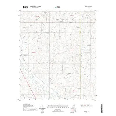
2020 Map of Seminary
USGS Topo · Published 2020About this map
Okatoma Creek carves a path through the heart of this Covington and Jones County landscape, where rural communities like Seminary and Eminence define the social geography. The terrain is notably dense with family and community burial grounds, from Eminence Cem in the north to Union Cem near the southern border, providing a clear spatial record for genealogical research. The road network, including Watts Rd and Jap Leggett Rd, connects small settlements such as Oak Bowery and Gandsi across a landscape etched by numerous small watercourses like Wolfpen Br and Kelly Cr. This 2020 survey documents the enduring rural character of the region, where legacy names like Morgan Field and various local landmarks persist alongside the primary drainage of the W Fork and Lower Prong.
Find a feature on this map
118 named features on this map. Tap any name to fly to it.
Don’t see what you’re looking for? This feature index may not catch every label — zoom into the map to look around manually.
Map Details
Editions of this 2020 Seminary Map
This is the sole edition of this map. No revisions or reprints were ever made.
Other maps of this area

1953 · Hattiesburg
USGS Topo · 1:250,000

1958 · Hattiesburg
USGS Topo · 1:250,000

1964 · Seminary
USGS Topo · 1:24,000

1965 · Hebron
USGS Topo · 1:24,000

1965 · Eastabuchie
USGS Topo · 1:24,000

1965 · Hot Coffee
USGS Topo · 1:24,000

1965 · Moselle
USGS Topo · 1:24,000

1965 · Sanford
USGS Topo · 1:24,000

1974 · Sumrall
USGS Topo · 1:24,000

1974 · Williamsburg
USGS Topo · 1:24,000