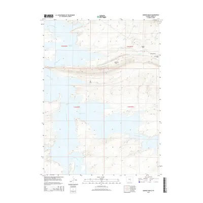
2015 Map of Seminoe Dam SE
USGS Topo · Published 2015About this map
North Platte River and Medicine Bow River converge within the extensive waters of the Seminoe Reservoir, dominating the hydrologic landscape of this Carbon County region. The topography is defined by a series of high-desert drainage patterns and elevated landforms, most notably the prominent Horseshoe Ridge which runs east-to-west across the central portion of the sheet. The map reveals a complex network of seasonal watercourses and catchments, including Red Reservoir and Dry Reservoir, which support the arid high-plains ecosystem. Numerous named topographic depressions such as Big Draw, McNees Draw, and Homestake Draw highlight the erosional history of the basin. These features, along with tributaries like Saylor Cr and Beaver Jimmy Cr, illustrate the intricate drainage systems that feed into the central reservoir system during periods of runoff.
Find a feature on this map
19 named features on this map. Tap any name to fly to it.
Don’t see what you’re looking for? This feature index may not catch every label — zoom into the map to look around manually.
Map Details
Editions of this 2015 Seminoe Dam SE Map
This is the sole edition of this map. No revisions or reprints were ever made.
Other maps of this area

1893 · Fort Steele
USGS Topo · 1:125,000

1914 · Hanna
USGS Topo · 1:62,500

1914 · Walcott
USGS Topo · 1:62,500

1953 · Seminoe Dam NE
USGS Topo · 1:24,000

1953 · Seminoe Dam
USGS Topo · 1:24,000

1953 · Seminoe Dam SW
USGS Topo · 1:24,000

1953 · Seminoe Dam SE
USGS Topo · 1:24,000

1953 · Schneider Ridge
USGS Topo · 1:24,000

1953 · Beaver Creek
USGS Topo · 1:24,000

1954 · Rawlins
USGS Topo · 1:250,000