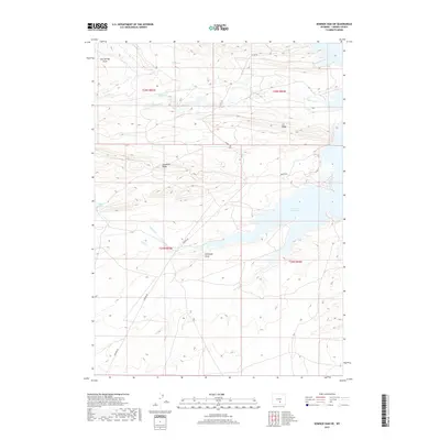
2017 Map of Seminoe Dam SW
USGS Topo · Published 2017About this map
Seminoe Reservoir dominates the eastern portion of this high-altitude Wyoming landscape, where the waters of the North Platte River are impounded against a complex series of drainage draws and high ridges. The terrain is defined by dramatic topographic shifts, moving from the shoreline of the reservoir to elevated features like Cheyenne Ridge and the uniquely named I D Ridge. This 2017 study illustrates a region primarily accessed via Seminoe Rd, serving as a vital record of water management and land navigation in Carbon County.
Find a feature on this map
18 named features on this map. Tap any name to fly to it.
Don’t see what you’re looking for? This feature index may not catch every label — zoom into the map to look around manually.
Map Details
Editions of this 2017 Seminoe Dam SW Map
This is the sole edition of this map. No revisions or reprints were ever made.
Other maps of this area

1893 · Fort Steele
USGS Topo · 1:125,000

1914 · Walcott
USGS Topo · 1:62,500

1953 · Bradley Peak
USGS Topo · 1:24,000

1953 · Seminoe Dam NE
USGS Topo · 1:24,000

1953 · Seminoe Dam
USGS Topo · 1:24,000

1953 · Wild Horse Mountain
USGS Topo · 1:24,000

1953 · Seminoe Dam SW
USGS Topo · 1:24,000

1953 · Seminoe Dam SE
USGS Topo · 1:24,000

1953 · Lone Haystack Mountain
USGS Topo · 1:24,000

1954 · Rawlins
USGS Topo · 1:250,000