
1953 Map of Bradley Peak
USGS Topo · Published 1955About this map
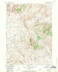
High-elevation terrain defines this 1953 survey of the Wyoming backcountry, where the Ferris Mountains and Seminoe Mountains converge. The landscape is marked by the remnants of early 20th-century isolation, most notably the Elkhorn Stage Station (Ruins) and several deserted homesteads like the R S Ranch and Boot Ranch. Resource extraction is evident in the presence of the Coal Mine and the inactive Sunday Morning Mine, while water management is highlighted by a prominent Ditch system serving the high desert basins. These features, along with the landmark summit of Bradley Peak, illustrate the rugged transition between ranching and mining operations in Carbon County. The map provides a detailed look at the hydrology of the area, from the seasonal Sand Springs to the waters of Mahoney Lake, set against a backdrop of steep ridges like Junk Hill and Windy Ridge.
Find a feature on this map
42 named features on this map. Tap any name to fly to it.
Don’t see what you’re looking for? This feature index may not catch every label — zoom into the map to look around manually.
Map Details
Editions of this 1953 Bradley Peak Map
4 editions found
Other maps of this area

1953 · Seminoe Dam
USGS Topo · 1:24,000

1953 · Wild Horse Mountain
USGS Topo · 1:24,000

1953 · Seminoe Dam SW
USGS Topo · 1:24,000

1953 · Ferris
USGS Topo · 1:24,000

1953 · Pathfinder Reservoir SW
USGS Topo · 1:24,000

1953 · Buzzard Ranch
USGS Topo · 1:24,000

1953 · Spanish Mine
USGS Topo · 1:24,000

1953 · Riddle Cut
USGS Topo · 1:24,000

1955 · Casper
USGS Topo · 1:250,000

1958 · Casper
USGS Topo · 1:250,000