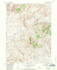
1953 Map of Bradley Peak
USGS Topo · Published 1971About this map
Bradley Peak and the high ridges of the Seminoe Mountains dominate this early 1950s survey of the Wyoming backcountry. The landscape reflects a transition from early pioneer transit to mid-century industrial interests, anchored by the Elkhorn Stage Station (Ruins) and the Seminoe Road. While agricultural life is represented by the R S Ranch (Aband) and Boot Ranch (Aband), the map captures active extractive efforts such as the Sunday Morning Mine (Active) and a Coal Mine to the south. The complex drainage of Deweese Creek and the Junk Creek watershed is clearly delineated alongside unique geological features like the Sand Dunes near Bear Mountain. This survey was conducted as part of the Department of the Interior's Missouri River Basin development program, documenting a moment when old stage routes were giving way to modern infrastructure like the nearby Pipe Line.
Find a feature on this map
40 named features on this map. Tap any name to fly to it.
Don’t see what you’re looking for? This feature index may not catch every label — zoom into the map to look around manually.
Map Details
Editions of this 1953 Bradley Peak Map
4 editions found
Other maps of this area

1953 · Bradley Peak
USGS Topo · 1:24,000

1953 · Seminoe Dam
USGS Topo · 1:24,000

1953 · Wild Horse Mountain
USGS Topo · 1:24,000

1953 · Seminoe Dam SW
USGS Topo · 1:24,000

1953 · Ferris
USGS Topo · 1:24,000

1953 · Pathfinder Reservoir SW
USGS Topo · 1:24,000

1953 · Buzzard Ranch
USGS Topo · 1:24,000

1953 · Spanish Mine
USGS Topo · 1:24,000

1953 · Riddle Cut
USGS Topo · 1:24,000

1955 · Casper
USGS Topo · 1:250,000