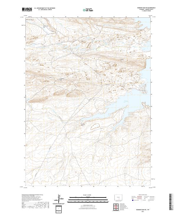
2021 Map of Seminoe Dam SW
USGS Topo · Published 2021About this map
Seminoe Reservoir dominates the eastern landscape of this high-altitude Wyoming region, where the shoreline meets a network of dry washes and seasonal creeks. The terrain is defined by prominent elevations such as Cheyenne Ridge and I D Ridge, which rise above the surrounding drainage basins of O'Brien Cr and Hurt Cr. This 2021 survey illustrates a sparse ranching and recreational environment, where infrastructure is limited to secondary routes like Seminoe Rd and the Seminoe Boat Club Rd, providing access to the water's edge.
Find a feature on this map
19 named features on this map. Tap any name to fly to it.
Don’t see what you’re looking for? This feature index may not catch every label — zoom into the map to look around manually.
Map Details
Editions of this 2021 Seminoe Dam SW Map
This is the sole edition of this map. No revisions or reprints were ever made.
Other maps of this area

1893 · Fort Steele
USGS Topo · 1:125,000

1914 · Walcott
USGS Topo · 1:62,500

1953 · Bradley Peak
USGS Topo · 1:24,000

1953 · Seminoe Dam NE
USGS Topo · 1:24,000

1953 · Seminoe Dam
USGS Topo · 1:24,000

1953 · Wild Horse Mountain
USGS Topo · 1:24,000

1953 · Seminoe Dam SW
USGS Topo · 1:24,000

1953 · Seminoe Dam SE
USGS Topo · 1:24,000

1953 · Lone Haystack Mountain
USGS Topo · 1:24,000

1954 · Rawlins
USGS Topo · 1:250,000