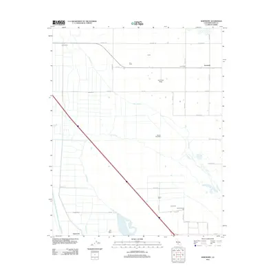
2012 Map of Semitropic
USGS Topo · Published 2012About this map
Semitropic Ridge rises slightly above the ancient Goose Lake Bed in this early 21st-century view of the southern San Joaquin Valley. The landscape is defined by an intensive network of water management features, including the East Side Canal, Goose Lake Canal, and the Kern-River-Flood-Canal, which support the region's agricultural economy. Family-held lands and agricultural operations such as Milham Farm, Estrada Ranch, and Blue Moon Ranch are scattered throughout the quadrangle, illustrating the enduring ranching tradition of Kern County.
Find a feature on this map
39 named features on this map. Tap any name to fly to it.
Don’t see what you’re looking for? This feature index may not catch every label — zoom into the map to look around manually.
Map Details
Editions of this 2012 Semitropic Map
This is the sole edition of this map. No revisions or reprints were ever made.
Other maps of this area

1910 · Buena Vista Lake
USGS Topo · 1:125,000

1912 · McKittrick
USGS Topo · 1:125,000

1912 · Buena Vista Lake
USGS Topo · 1:125,000

1914 · Lost Hills
USGS Topo · 1:125,000

1927 · Semitropic
USGS Topo · 1:31,680

1930 · Leonards
USGS Topo · 1:31,680

1930 · Hamlin School
USGS Topo · 1:31,680

1930 · Miramonte Ranch
USGS Topo · 1:31,680

1931 · Lokern
USGS Topo · 1:31,680

1931 · Goose Lake
USGS Topo · 1:31,680