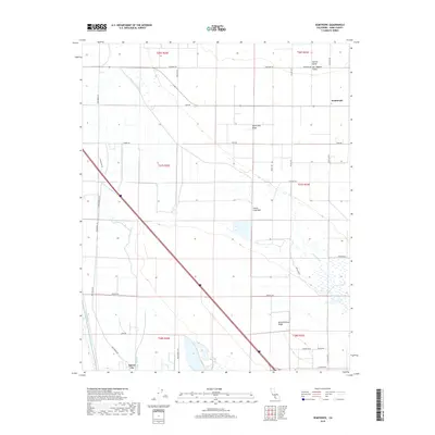
2018 Map of Semitropic
USGS Topo · Published 2018About this map
The agricultural expanse of the Central Valley is defined here by a complex network of water management features designed to reclaim the arid basin. Historically dominated by the Goose Lake Bed, the landscape is now segmented by an intricate system of irrigation and drainage, including the Goose Lake Canal, the Main Drain, and the Belridge Ditch. These engineering works, along with the Main Drain Levee, have transformed the basin into a productive landscape where the small settlements of Semitropic and Spicer City stand as local landmarks. Slight topographic variations like Semitropic Ridge and Buttonwillow Ridge provide the only relief in this low-lying area. The map also traces the path of Jerry Slough and the E-Side-Canal, illustrating how the hydrology of the San Joaquin Valley has been entirely reconfigured for 21st-century agricultural use.
Find a feature on this map
39 named features on this map. Tap any name to fly to it.
Don’t see what you’re looking for? This feature index may not catch every label — zoom into the map to look around manually.
Map Details
Editions of this 2018 Semitropic Map
This is the sole edition of this map. No revisions or reprints were ever made.
Other maps of this area

1910 · Buena Vista Lake
USGS Topo · 1:125,000

1912 · McKittrick
USGS Topo · 1:125,000

1912 · Buena Vista Lake
USGS Topo · 1:125,000

1914 · Lost Hills
USGS Topo · 1:125,000

1927 · Semitropic
USGS Topo · 1:31,680

1930 · Leonards
USGS Topo · 1:31,680

1930 · Hamlin School
USGS Topo · 1:31,680

1930 · Miramonte Ranch
USGS Topo · 1:31,680

1931 · Lokern
USGS Topo · 1:31,680

1931 · Goose Lake
USGS Topo · 1:31,680