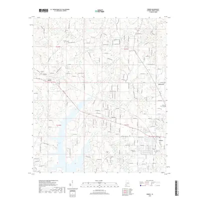
2018 Map of Semmes
USGS Topo · Published 2018About this map
Big Creek Lake dominates the southwestern portion of this Mobile County landscape, where the waters of Big Creek and Boggy Branch converge. The area is defined by a dense network of small waterways, including Crooked Creek, Red Creek, and Gallops Creek, which weave through the residential and agricultural sections of Semmes, Wilmer, and Fairview. These settlements are linked by a historical road system that includes the legacy of the Natchez Trail and the eponymous Natchez Trace Road.
Find a feature on this map
164 named features on this map. Tap any name to fly to it.
Don’t see what you’re looking for? This feature index may not catch every label — zoom into the map to look around manually.
Map Details
Editions of this 2018 Semmes Map
This is the sole edition of this map. No revisions or reprints were ever made.
Other maps of this area

1922 · Mobile
USGS Topo · 1:62,500

1940 · Mobile
USGS Topo · 1:62,500

1941 · Hurley
USGS Topo · 1:62,500

1941 · Creola
USGS Topo · 1:62,500

1942 · Kushla
USGS Topo · 1:31,680

1942 · Wilmer
USGS Topo · 1:62,500

1943 · Creola
USGS Topo · 1:62,500

1943 · Hurley
USGS Topo · 1:62,500
1943 · Spring Hill
USGS Topo · 1:31,680
1944 · Mobile
USGS Topo · 1:62,500