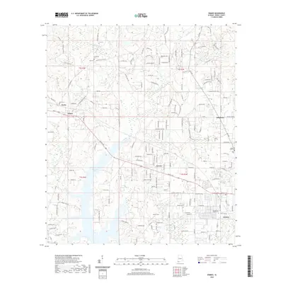
2020 Map of Semmes
USGS Topo · Published 2020About this map
Big Creek Lake dominates the central and southern portions of this landscape, its western branches reaching toward the rural communities of Warley and Wilmer. The map reveals a transition from these older nodes to the growing residential footprints of Fairview and the town of Semmes. Family history is deeply rooted here, evidenced by numerous small burial grounds including Stringfellow Cem, Morris Cem, and Ford Cem in the north, while the Semmes First Baptist Cem serves the more established town center to the southeast.
Find a feature on this map
173 named features on this map. Tap any name to fly to it.
Don’t see what you’re looking for? This feature index may not catch every label — zoom into the map to look around manually.
Map Details
Editions of this 2020 Semmes Map
This is the sole edition of this map. No revisions or reprints were ever made.
Other maps of this area

1922 · Mobile
USGS Topo · 1:62,500

1940 · Mobile
USGS Topo · 1:62,500

1941 · Hurley
USGS Topo · 1:62,500

1941 · Creola
USGS Topo · 1:62,500

1942 · Kushla
USGS Topo · 1:31,680

1942 · Wilmer
USGS Topo · 1:62,500

1943 · Creola
USGS Topo · 1:62,500

1943 · Hurley
USGS Topo · 1:62,500
1943 · Spring Hill
USGS Topo · 1:31,680
1944 · Mobile
USGS Topo · 1:62,500