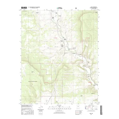
2017 Map of Sena
USGS Topo · Published 2017About this map
The Pecos River carves a deep valley through the high mesas of San Miguel County, anchoring a string of traditional settlements along its course. This 2017 study illustrates a centuries-old pattern of communal land use and village life, where the river's path dictates the placement of towns like Ribera, Sena, and Villanueva. The topography is defined by significant elevations, notably the Hurtado Mesa and the wide expanse of the Santa Fe National Forest in the southwest quadrant.
Find a feature on this map
43 named features on this map. Tap any name to fly to it.
Don’t see what you’re looking for? This feature index may not catch every label — zoom into the map to look around manually.
Map Details
Editions of this 2017 Sena Map
This is the sole edition of this map. No revisions or reprints were ever made.
Other maps of this area

1890 · Bernal
USGS Topo · 1:125,000

1891 · Bernal
USGS Topo · 1:125,000

1894 · Bernal
USGS Topo · 1:125,000

1894 · Lamy
USGS Topo · 1:125,000

1954 · Santa Fe
USGS Topo · 1:250,000

1958 · Santa Fe
USGS Topo · 1:250,000

1960 · Villanueva
USGS Topo · 1:62,500

1963 · Aurora
USGS Topo · 1:24,000
1963 · San Juan
USGS Topo · 1:24,000
1966 · Laguna Ortiz
USGS Topo · 1:24,000