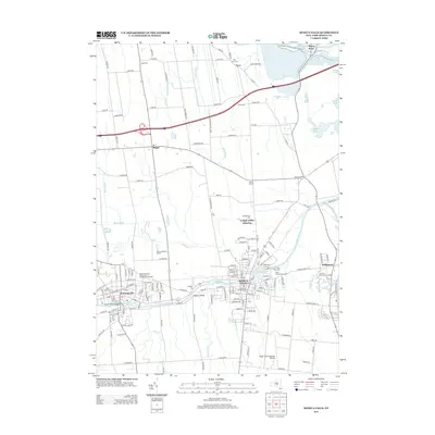
2013 Map of Seneca Falls
USGS Topo · Published 2013About this map
The industrial and canal history of the Finger Lakes region is centered here along the Seneca River, where the village of Seneca Falls sits adjacent to Van Cleef Lake. To the west, Waterloo serves as a secondary hub of settlement, with the Seneca County Agricultural Society Fair Grounds marking the edge of the community. This 2013 survey illustrates the dense layering of local heritage, from the final resting place of early residents at Ovid Street Pioneers Cem to the modern operations at the Seneca Meadows Landfill.
Find a feature on this map
115 named features on this map. Tap any name to fly to it.
Don’t see what you’re looking for? This feature index may not catch every label — zoom into the map to look around manually.
Map Details
Editions of this 2013 Seneca Falls Map
This is the sole edition of this map. No revisions or reprints were ever made.
Other maps of this area

1899 · Auburn
USGS Topo · 1:62,500

1902 · Geneva
USGS Topo · 1:62,500

1902 · Clyde
USGS Topo · 1:62,500

1902 · Weedsport
USGS Topo · 1:62,500

1902 · Auburn
USGS Topo · 1:62,500

1943 · Lyons
USGS Topo · 1:31,680

1943 · Geneva North
USGS Topo · 1:31,680

1943 · Geneva South
USGS Topo · 1:31,680

1943 · Montezuma
USGS Topo · 1:31,680

1943 · Cayuga
USGS Topo · 1:31,680