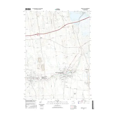
2016 Map of Seneca Falls
USGS Topo · Published 2016About this map
Seneca Falls and Waterloo serve as the primary cultural anchors of this Central New York landscape, which is defined by its deep ties to social history and its complex water network. The Seneca River and the Erie Canal flow through the heart of the region, feeding into Van Cleef Lake and creating a corridor of transit and power that fueled the area's development. Much of the urban landscape is dedicated to commemorative sites, most notably the Women's Rights National Historical Park, which preserves the legacy of the 1848 convention across multiple locations in both villages.
Find a feature on this map
137 named features on this map. Tap any name to fly to it.
Don’t see what you’re looking for? This feature index may not catch every label — zoom into the map to look around manually.
Map Details
Editions of this 2016 Seneca Falls Map
This is the sole edition of this map. No revisions or reprints were ever made.
Other maps of this area

1899 · Auburn
USGS Topo · 1:62,500

1902 · Geneva
USGS Topo · 1:62,500

1902 · Clyde
USGS Topo · 1:62,500

1902 · Weedsport
USGS Topo · 1:62,500

1902 · Auburn
USGS Topo · 1:62,500

1943 · Lyons
USGS Topo · 1:31,680

1943 · Geneva North
USGS Topo · 1:31,680

1943 · Geneva South
USGS Topo · 1:31,680

1943 · Montezuma
USGS Topo · 1:31,680

1943 · Cayuga
USGS Topo · 1:31,680