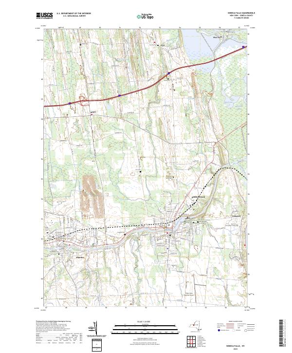
2023 Map of Seneca Falls
USGS Topo · Published 2023About this map
The Seneca River and the storied Erie Canal define the industrial and civic heart of this central New York landscape, connecting the neighboring villages of Seneca Falls and Waterloo. As a focal point for social reform and local governance, the area is anchored by the Women's Rights National Historical Park and the Seneca County Courthouse. The map reveals a dense network of local history, from the Finger Lakes Railway corridors to numerous family and community burial grounds such as Kingdom Cem and the Samuel Bear Cem.
Find a feature on this map
113 named features on this map. Tap any name to fly to it.
Don’t see what you’re looking for? This feature index may not catch every label — zoom into the map to look around manually.
Map Details
Editions of this 2023 Seneca Falls Map
This is the sole edition of this map. No revisions or reprints were ever made.
Other maps of this area

1899 · Auburn
USGS Topo · 1:62,500

1902 · Geneva
USGS Topo · 1:62,500

1902 · Clyde
USGS Topo · 1:62,500

1902 · Weedsport
USGS Topo · 1:62,500

1902 · Auburn
USGS Topo · 1:62,500

1943 · Lyons
USGS Topo · 1:31,680

1943 · Geneva North
USGS Topo · 1:31,680

1943 · Geneva South
USGS Topo · 1:31,680

1943 · Montezuma
USGS Topo · 1:31,680

1943 · Cayuga
USGS Topo · 1:31,680