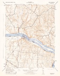
1944 Map of Seneca
USGS Topo · Published 1944About this map
The Potomac River corridor serves as the central artery for this 1944 War Department survey, marking the border between Maryland and Virginia. Along the northern bank, the Chesapeake and Ohio Canal follows the river's curve past Blockhouse Point, indicating the historical importance of this transport waterway. In the uplands of Montgomery County, the rural crossroads of Darnestown and Quince Orchard are connected by State Hwy. No. 28, while the hamlet of Seneca sits at the confluence of the river and Seneca Creek. This survey captures the region's mid-century landscape of family-named settlements and geographic markers like Watkins Island and Sycamore Island. On the Virginia side, the topography is defined by drainage patterns including Sugarland Run and Nichols Branch, leading toward the community of Dranesville and the railroad-adjacent Herndon Junction.
Find a feature on this map
40 named features on this map. Tap any name to fly to it.
Don’t see what you’re looking for? This feature index may not catch every label — zoom into the map to look around manually.
Map Details
Editions of this 1944 Seneca Map
2 editions found
Other maps of this area

1890 · Mt. Vernon
USGS Topo · 1:125,000

1891 · Mt. Vernon
USGS Topo · 1:125,000

1893 · Frederick
USGS Topo · 1:125,000

1894 · Frederick
USGS Topo · 1:125,000

1894 · Mt. Vernon
USGS Topo · 1:125,000

1897 · Mt. Vernon
USGS Topo · 1:125,000

1900 · Washington
USGS Topo · 1:62,500

1908 · Rockville
USGS Topo · 1:62,500

1908 · Seneca
USGS Topo · 1:62,500

1915 · Fairfax
USGS Topo · 1:62,500