
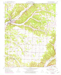
1949 Map of Seneca
USGS Topo · Published 1970About this map
Seneca serves as the focal point of this 1949 topographic survey, situated at the critical junction of the St Louis San Francisco railroad and the border between Missouri and Oklahoma. The landscape reveals a deeply integrated network of rural social centers and early industrial sites. Local life is anchored by multiple country schools, including Gallemore Sch and Hickory Grove Sch, alongside prominent religious institutions like the Swars Prairie Church of Christ.
Find a feature on this map
29 named features on this map. Tap any name to fly to it.
Don’t see what you’re looking for? This feature index may not catch every label — zoom into the map to look around manually.
Map Details
Editions of this 1949 Seneca Map
2 editions found
Other maps of this area

1907 · Wyandotte
USGS Topo · 1:125,000

1909 · Wyandotte
USGS Topo · 1:125,000

1916 · Neosho
USGS Topo · 1:62,500

1940 · Noel
USGS Topo · 1:62,500

1943 · Noel
USGS Topo · 1:62,500

1949 · Racine
USGS Topo · 1:24,000

1950 · Seneca
USGS Topo · 1:24,000

1950 · Racine
USGS Topo · 1:24,000

1954 · Tulsa
USGS Topo · 1:250,000

1958 · Tulsa
USGS Topo · 1:250,000