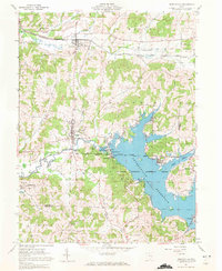
1961 Map of Senecaville
USGS Topo · Published 1972About this map
Senecaville Reservoir dominates the landscape of southeastern Guernsey County, serving as the centerpiece for the Muskingum Watershed Conservancy District. Managed for flood control and recreation, the reservoir is anchored by the Senecaville Dam and the adjacent Senecaville National Fish Hatchery. The northern portion of the map reveals the industrial and institutional history of the area, featuring the Baltimore and Ohio railroad corridor running through Lore City and past the Infirmary.
Find a feature on this map
44 named features on this map. Tap any name to fly to it.
Don’t see what you’re looking for? This feature index may not catch every label — zoom into the map to look around manually.
Map Details
Editions of this 1961 Senecaville Map
3 editions found
Other maps of this area

1909 · Antrim
USGS Topo · 1:48,000

1909 · Summerfield
USGS Topo · 1:62,500

1909 · Cambridge
USGS Topo · 1:62,500

1911 · Antrim
USGS Topo · 1:62,500

1911 · Cumberland
USGS Topo · 1:62,500

1911 · Summerfield
USGS Topo · 1:62,500

1912 · Cambridge
USGS Topo · 1:62,500

1949 · Clarksburg
USGS Topo · 1:250,000

1951 · Canton
USGS Topo · 1:250,000

1953 · Canton
USGS Topo · 1:250,000