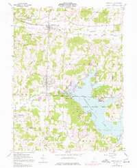
1961 Map of Senecaville
USGS Topo · Published 1977About this map
Lore City and Senecaville anchor this portion of southeastern Ohio, where the local economy transition from extraction to conservation is clearly visible. The heavy footprint of industry is marked by numerous Oil Wells, a sprawling Strip Mine, and the site of Kings Mine in the north. This industrial activity is contrasted by the development of the Senecaville Lake reservoir, managed by the Muskingum Watershed Conservancy District. The creation of the Senecaville Dam across Wills Creek reshaped the local geography, leading to the establishment of the Senecaville National Fish Hatchery.
Find a feature on this map
58 named features on this map. Tap any name to fly to it.
Don’t see what you’re looking for? This feature index may not catch every label — zoom into the map to look around manually.
Map Details
Editions of this 1961 Senecaville Map
3 editions found
Other maps of this area

1909 · Antrim
USGS Topo · 1:48,000

1909 · Summerfield
USGS Topo · 1:62,500

1909 · Cambridge
USGS Topo · 1:62,500

1911 · Antrim
USGS Topo · 1:62,500

1911 · Cumberland
USGS Topo · 1:62,500

1911 · Summerfield
USGS Topo · 1:62,500

1912 · Cambridge
USGS Topo · 1:62,500

1949 · Clarksburg
USGS Topo · 1:250,000

1951 · Canton
USGS Topo · 1:250,000

1953 · Canton
USGS Topo · 1:250,000