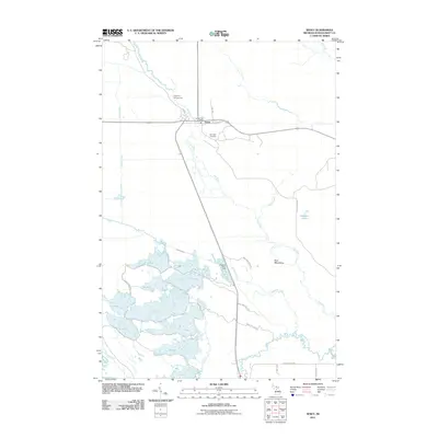
2011 Map of Seney
USGS Topo · Published 2011About this map
Seney serves as a small hub of activity in this northern landscape, situated where the Seney Railroad St and local routes intersect near the Seney Post Office. The town is flanked by a significant water management system to the south and west, where labels such as A Pool, B Pool, and C Pool indicate a complex of managed wetlands or impoundments. These features, along with Holland Ditch and Clarks Ditch, suggest a landscape heavily modified for conservation or drainage purposes.
Find a feature on this map
35 named features on this map. Tap any name to fly to it.
Don’t see what you’re looking for? This feature index may not catch every label — zoom into the map to look around manually.
Map Details
Editions of this 2011 Seney Map
This is the sole edition of this map. No revisions or reprints were ever made.
Other maps of this area

1931 · Seney SW
USGS Topo · 1:31,680

1931 · Seney NW
USGS Topo · 1:31,680

1931 · Manistique River NE
USGS Topo · 1:31,680

1931 · Driggs Lake NE
USGS Topo · 1:31,680

1931 · Seney SE
USGS Topo · 1:31,680

1931 · Blaney NE
USGS Topo · 1:31,680

1931 · Blaney NW
USGS Topo · 1:31,680

1931 · Driggs Lake SE
USGS Topo · 1:31,680

1954 · Sault Sainte Marie
USGS Topo · 1:250,000

1956 · Sault Sainte Marie
USGS Topo · 1:250,000