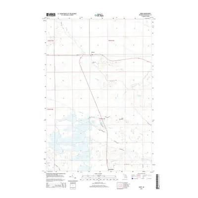
2014 Map of Seney
USGS Topo · Published 2014About this map
The Seney settlement and the northern portion of the Seney Wildlife Refuge define this section of Michigan’s Upper Peninsula. This landscape is a complex hydraulic system where the Fox River and Manistique River meet a network of engineered waterways and managed pools. Significant landmarks like Boot Hill Cem near the intersection of M-77 and M-28 point to the area's local history, while the Blue Mountains provide the only significant elevation in an otherwise marshy expanse. The southern portion of the map is dominated by the refuge’s large management units, including B Pool, C Pool, and D Pool, which are connected by features like Holland Ditch and the Grays Cr. Access to these wetlands is traced through the Pine Ridge Nature Trail and the S Show Pool Trail, illustrating the region's 21st-century role as a conservation and recreational hub south of Seney.
Find a feature on this map
43 named features on this map. Tap any name to fly to it.
Don’t see what you’re looking for? This feature index may not catch every label — zoom into the map to look around manually.
Map Details
Editions of this 2014 Seney Map
This is the sole edition of this map. No revisions or reprints were ever made.
Other maps of this area

1931 · Seney SW
USGS Topo · 1:31,680

1931 · Seney NW
USGS Topo · 1:31,680

1931 · Manistique River NE
USGS Topo · 1:31,680

1931 · Driggs Lake NE
USGS Topo · 1:31,680

1931 · Seney SE
USGS Topo · 1:31,680

1931 · Blaney NE
USGS Topo · 1:31,680

1931 · Blaney NW
USGS Topo · 1:31,680

1931 · Driggs Lake SE
USGS Topo · 1:31,680

1954 · Sault Sainte Marie
USGS Topo · 1:250,000

1956 · Sault Sainte Marie
USGS Topo · 1:250,000