
1931 Map of Seney SE
USGS Topo · Published 1931About this map
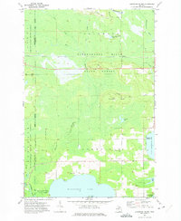
The sprawling marshlands and northern timberlands of the Upper Peninsula define this 1931 survey of the border between Schoolcraft and Luce counties. The landscape is dominated by the massive expanse of Manistique Lake and the smaller North Manistique Lake to the northeast. Transportation through this water-rich terrain is limited to a few critical arteries, primarily State Highway No 28 and the D S S and A railroad corridor, which cut east-west across the low-lying basin. The isolation of the area at this time is underscored by the presence of the Smithers Sch as a lonely landmark of local community. Waterways like the Manistique River and East Branch Fox River serve as the primary drainage for the surrounding swamps, reflecting a wilderness region just beginning to see modern infrastructure.
Find a feature on this map
10 named features on this map. Tap any name to fly to it.
Don’t see what you’re looking for? This feature index may not catch every label — zoom into the map to look around manually.
Map Details
Editions of this 1931 Seney SE Map
This is the sole edition of this map. No revisions or reprints were ever made.
Other maps of this area

1931 · Seney SW
USGS Topo · 1:31,680

1931 · Seney NW
USGS Topo · 1:31,680

1931 · Gould City NW
USGS Topo · 1:31,680

1931 · Blaney NE
USGS Topo · 1:31,680

1931 · Blaney NW
USGS Topo · 1:31,680

1954 · Sault Sainte Marie
USGS Topo · 1:250,000

1956 · Sault Sainte Marie
USGS Topo · 1:250,000

1957 · Sault Sainte Marie
USGS Topo · 1:250,000

1958 · Sault Sainte Marie
USGS Topo · 1:250,000
1972 · Hardwood Island
USGS Topo · 1:24,000