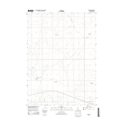
2013 Map of Senter
USGS Topo · Published 2013About this map
Antelope Reservoir and Corral Reservoir define the water management landscape of Lincoln County in this high-desert region of Idaho. The small settlement of Senter sits near the southern boundary, positioned along the corridor of Id-24 and E Senter Rd. This area is characterized by scattered natural and man-made water features, including Sid Lake Number One and Sid Lake Number Two, which serve the local ranching or agricultural needs. The road network, featuring routes like Richfield Sid Rd and Shale Butte Rd, highlights the connectivity between isolated outposts and the larger surrounding township sections such as t5s r21e. To the southeast, North Center Lake provides a notable landmark near the intersection of local transportation routes.
Find a feature on this map
16 named features on this map. Tap any name to fly to it.
Don’t see what you’re looking for? This feature index may not catch every label — zoom into the map to look around manually.
Map Details
Editions of this 2013 Senter Map
This is the sole edition of this map. No revisions or reprints were ever made.
Other maps of this area

1954 · Pocatello
USGS Topo · 1:250,000

1955 · Idaho Falls
USGS Topo · 1:250,000

1955 · Twin Falls
USGS Topo · 1:250,000

1955 · Hailey
USGS Topo · 1:250,000

1958 · Twin Falls
USGS Topo · 1:250,000

1958 · Idaho Falls
USGS Topo · 1:250,000

1958 · Pocatello
USGS Topo · 1:250,000

1959 · Hailey
USGS Topo · 1:250,000

1962 · Hailey
USGS Topo · 1:250,000

1971 · Owinza
USGS Topo · 1:24,000