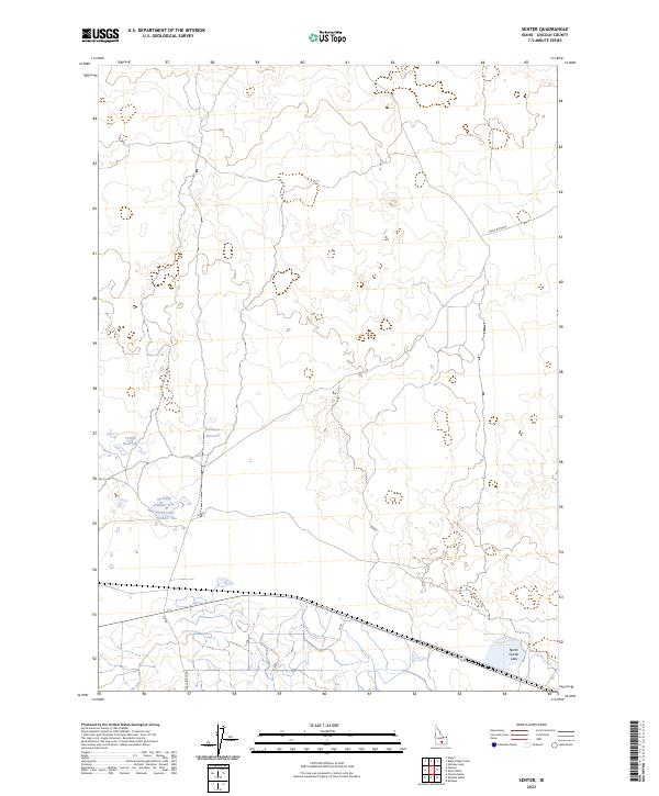
2023 Map of Senter
USGS Topo · Published 2023About this map
Antelope Reservoir and Corral Reservoir are central features of this arid Lincoln County landscape, highlighting the critical importance of water management in southern Idaho. The map reveals a high-desert environment characterized by ephemeral basins and small, numbered water bodies such as Sid Lake Number One and Sid Lake Number Two. Isolated thoroughfares like Shale Butte Rd and Sid Rd serve as the primary conduits through these expansive townships. Near the southeastern corner, the presence of North Center Lake further emphasizes the cluster of hydrological features that define this specific section of the Snake River Plain. The spatial organization follows the Public Land Survey System, with grid lines for T5S R21E and T6S R21E providing a rigid structure over the undulating topography.
Find a feature on this map
11 named features on this map. Tap any name to fly to it.
Don’t see what you’re looking for? This feature index may not catch every label — zoom into the map to look around manually.
Map Details
Editions of this 2023 Senter Map
This is the sole edition of this map. No revisions or reprints were ever made.
Other maps of this area

1954 · Pocatello
USGS Topo · 1:250,000

1955 · Idaho Falls
USGS Topo · 1:250,000

1955 · Twin Falls
USGS Topo · 1:250,000

1955 · Hailey
USGS Topo · 1:250,000

1958 · Twin Falls
USGS Topo · 1:250,000

1958 · Idaho Falls
USGS Topo · 1:250,000

1958 · Pocatello
USGS Topo · 1:250,000

1959 · Hailey
USGS Topo · 1:250,000

1962 · Hailey
USGS Topo · 1:250,000

1971 · Owinza
USGS Topo · 1:24,000