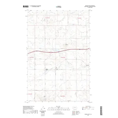
2020 Map of Sentinel Butte
USGS Topo · Published 2020About this map
Sentinel Butte dominates the central portion of this Golden Valley County landscape, anchoring a region defined by high plains topography and significant landmarks. The settlement of Sentinel Butte serves as the local hub, situated just south of the interstate corridor and north of its namesake peak. To the east, the smaller locality of De Mores sits near the winding path of Andrews Creek, illustrating the dispersed ranching and agricultural pattern typical of western North Dakota.
Find a feature on this map
34 named features on this map. Tap any name to fly to it.
Don’t see what you’re looking for? This feature index may not catch every label — zoom into the map to look around manually.
Map Details
Editions of this 2020 Sentinel Butte Map
This is the sole edition of this map. No revisions or reprints were ever made.
Other maps of this area

1953 · Dickinson
USGS Topo · 1:250,000

1953 · Watford City
USGS Topo · 1:250,000

1957 · Dickinson
USGS Topo · 1:250,000

1957 · Watford City
USGS Topo · 1:250,000

1967 · Watford City
USGS Topo · 1:250,000

1974 · West Twin Butte
USGS Topo · 1:24,000
1974 · Hootowl Creek SW
USGS Topo · 1:24,000

1974 · Wannagan Creek West
USGS Topo · 1:24,000

1979 · Sentinel Butte SE
USGS Topo · 1:24,000
1979 · Buffalo Gap Campground
USGS Topo · 1:24,000