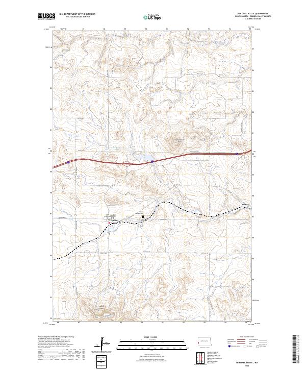
2024 Map of Sentinel Butte
USGS Topo · Published 2024About this map
Sentinel Butte rises as a prominent landmark south of the town that shares its name, anchoring a landscape of Golden Valley County defined by high buttes and seasonal drainage basins. The settlement of Sentinel Butte serves as a local hub, with its street grid including Gaffy St and connections to Old Hwy 10, which parallels the modern interstate corridor. Genealogists will find the community’s history preserved at Saint Michaels Cem and Sentinel Butte Cem, both situated near the town site. To the northeast, the distinct elevation of Camels Hump Butte stands near Camel Hump Rd, while the eastern portion of the map includes the location of De Mores. The terrain is etched by the winding paths of Andrews Creek and Knutson Creek, which drain the surrounding plateaus and reflect the area's arid ranching geography.
Find a feature on this map
28 named features on this map. Tap any name to fly to it.
Don’t see what you’re looking for? This feature index may not catch every label — zoom into the map to look around manually.
Map Details
Editions of this 2024 Sentinel Butte Map
This is the sole edition of this map. No revisions or reprints were ever made.
Other maps of this area

1953 · Dickinson
USGS Topo · 1:250,000

1953 · Watford City
USGS Topo · 1:250,000

1957 · Dickinson
USGS Topo · 1:250,000

1957 · Watford City
USGS Topo · 1:250,000

1967 · Watford City
USGS Topo · 1:250,000

1974 · West Twin Butte
USGS Topo · 1:24,000
1974 · Hootowl Creek SW
USGS Topo · 1:24,000

1974 · Wannagan Creek West
USGS Topo · 1:24,000

1979 · Sentinel Butte SE
USGS Topo · 1:24,000
1979 · Buffalo Gap Campground
USGS Topo · 1:24,000