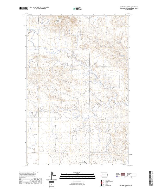
2024 Map of Sentinel Butte SE
USGS Topo · Published 2024About this map
Sentinel Butte rises as a prominent landmark in this corner of Golden Valley County, overlooking a landscape defined by the drainage of North Fork Garner Creek and its tributaries. The topography is marked by the branching waters of Fisher Run and the winding course of Garner Creek, which cut through the high plains of western North Dakota. This area remains largely defined by its rural road network, with routes like Red Hills Rd and Square Butte Rd tracing the section lines of the Public Land Survey System.
Find a feature on this map
21 named features on this map. Tap any name to fly to it.
Don’t see what you’re looking for? This feature index may not catch every label — zoom into the map to look around manually.
Map Details
Editions of this 2024 Sentinel Butte SE Map
This is the sole edition of this map. No revisions or reprints were ever made.
Other maps of this area

1953 · Dickinson
USGS Topo · 1:250,000

1957 · Dickinson
USGS Topo · 1:250,000

1979 · Sentinel Butte SE
USGS Topo · 1:24,000
1979 · Buffalo Gap Campground
USGS Topo · 1:24,000

1979 · Square Butte
USGS Topo · 1:24,000

1980 · Golva
USGS Topo · 1:24,000
1980 · Beach East
USGS Topo · 1:24,000
1980 · Sentinel Butte
USGS Topo · 1:24,000

1980 · Thelan
USGS Topo · 1:24,000

1980 · Alpha
USGS Topo · 1:24,000
Featured Places
- Lone Tree Township, ND
- Sentinel Township, ND
- Beach Township, ND
- Garner Township, ND
- Golden Valley County, ND