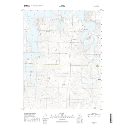
2017 Map of Sentinel
USGS Topo · Published 2017About this map
Pomme de Terre Lake dominates the northwest corner of this Missouri landscape, where the Pomme de Terre River and its numerous tributaries like Decker Br and Big Hollow Br have carved a complex network of ridges and hollows. The settlement pattern reflects the area's rural history, with small communities such as Pittsburg, Adonis, and Sentinel serving as local anchors. Genealogists will find a wealth of burial sites preserved across the terrain, including Oak Grove Baptist Cem, Antioch Cem, and Chamberlain Cem.
Find a feature on this map
102 named features on this map. Tap any name to fly to it.
Don’t see what you’re looking for? This feature index may not catch every label — zoom into the map to look around manually.
Map Details
Editions of this 2017 Sentinel Map
This is the sole edition of this map. No revisions or reprints were ever made.
Other maps of this area

1884 · Bolivar
USGS Topo · 1:125,000

1892 · Bolivar
USGS Topo · 1:125,000

1942 · Elkton
USGS Topo · 1:24,000

1949 · Elkton
USGS Topo · 1:24,000

1949 · Sentinel
USGS Topo · 1:24,000

1950 · Elkton
USGS Topo · 1:24,000

1950 · Sentinel
USGS Topo · 1:24,000

1950 · Buffalo NW
USGS Topo · 1:24,000

1950 · Polk
USGS Topo · 1:24,000

1950 · Urbana
USGS Topo · 1:24,000