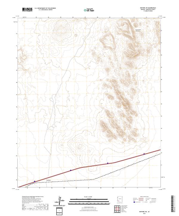
2021 Map of Sentinel NE
USGS Topo · Published 2021About this map
The southern Maricopa County desert near Tartron is defined by the sharp rise of the Painted Rock Mountains against the surrounding basin. This 2021 survey illustrates a sparse landscape where human presence is concentrated along the east-west corridor of Interstate 8, which bisects the southern portion of the quadrangle. The terrain transitions from flat valley floors to the complex, contour-heavy ridges of the mountains in the northeast, reflecting a typical Basin and Range topography. While modern infrastructure is limited primarily to this highway transit route, the map reveals the precise Public Land Survey System boundaries, including t5s r8w, t5s r7w, t6s r8w, and t6s r7w, which provide essential reference points for land ownership and historical property research in this arid region.
Find a feature on this map
7 named features on this map. Tap any name to fly to it.
Don’t see what you’re looking for? This feature index may not catch every label — zoom into the map to look around manually.
Map Details
Editions of this 2021 Sentinel NE Map
This is the sole edition of this map. No revisions or reprints were ever made.
Other maps of this area

1942 · Vicksburg
USGS Topo · 1:250,000

1949 · Sentinel
USGS Topo · 1:62,500

1950 · Sentinel
USGS Topo · 1:62,500

1950 · Theba
USGS Topo · 1:62,500

1951 · Theba
USGS Topo · 1:62,500

1951 · Dendora Valley
USGS Topo · 1:62,500

1951 · Woolsey Peak
USGS Topo · 1:62,500

1953 · Ajo
USGS Topo · 1:250,000

1954 · Phoenix
USGS Topo · 1:250,000

1957 · Ajo
USGS Topo · 1:250,000