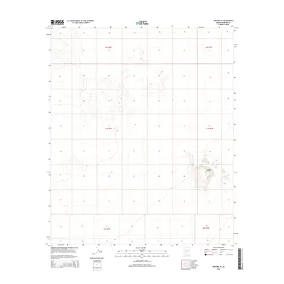
2014 Map of Sentinel SE
USGS Topo · Published 2014About this map
Cinder Mountain rises prominently from the arid plains of southwestern Arizona, serving as the primary geological landmark in this expanse of Maricopa County. This landscape is defined by its vast, open desert character and is systematically organized through the Public Land Survey System, as evidenced by the grid of township and range boundaries including t7s r8w and t8s r7w. The terrain is sparse, with subtle contour lines indicating the gentle slopes and washes characteristic of the regional desert floor, punctuated only by the distinct volcanic profile of the central mountain feature. This survey provides a clear view of the undeveloped territory prior to any significant modern infrastructure or settlement in this specific quadrangle.
Find a feature on this map
7 named features on this map. Tap any name to fly to it.
Don’t see what you’re looking for? This feature index may not catch every label — zoom into the map to look around manually.
Map Details
Editions of this 2014 Sentinel SE Map
This is the sole edition of this map. No revisions or reprints were ever made.
Other maps of this area

1949 · Sentinel
USGS Topo · 1:62,500

1950 · Sentinel
USGS Topo · 1:62,500

1950 · Theba
USGS Topo · 1:62,500

1951 · Theba
USGS Topo · 1:62,500

1953 · Ajo
USGS Topo · 1:250,000

1957 · Ajo
USGS Topo · 1:250,000

1958 · Ajo
USGS Topo · 1:250,000

1958 · Midway
USGS Topo · 1:62,500

1962 · Ajo
USGS Topo · 1:250,000

1963 · Ajo
USGS Topo · 1:250,000