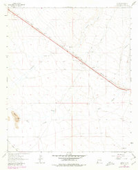
1964 Map of Separ
USGS Topo · Published 1980About this map
The Southern Pacific rail line cuts diagonally through this Grant County landscape, serving as the primary corridor for movement through a region defined by scattered cattle operations and water management. Ranching heritage is well-documented by the presence of Cox Ranch, Separ Ranch, and Moore Ranch, along with several named water sources like Kelly Well and Glaze Windmill. The small settlement of Separ anchors the central map, positioned where the railroad meets the drainage of Ninety-six Creek. To the southwest, an Old Railroad Grade and the elevated Pigeon Hill diversify the terrain, while the course of the Burro Cienaga meanders across the southern sections. This survey provides a record of the infrastructure required for high-desert ranching and the industrial footprint of the railway and its associated Borrow Pits in the early 1960s.
Find a feature on this map
18 named features on this map. Tap any name to fly to it.
Don’t see what you’re looking for? This feature index may not catch every label — zoom into the map to look around manually.
Map Details
Editions of this 1964 Separ Map
2 editions found
Other maps of this area

1954 · Silver City
USGS Topo · 1:250,000

1958 · Silver City
USGS Topo · 1:250,000

1962 · Silver City
USGS Topo · 1:250,000

1962 · Ninetysix Ranch
USGS Topo · 1:24,000

1962 · Lisbon
USGS Topo · 1:24,000

1963 · Soldiers Farewell Hill
USGS Topo · 1:24,000

1964 · Muir Ranch
USGS Topo · 1:24,000
1964 · The Saltys
USGS Topo · 1:24,000
1964 · Separ NE
USGS Topo · 1:24,000
1964 · Separ
USGS Topo · 1:24,000