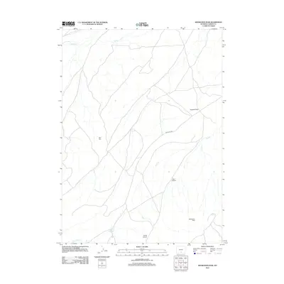
2012 Map of Separation Peak
USGS Topo · Published 2012About this map
Separation Peak rises above a high-altitude landscape in Carbon County, where the high desert terrain is defined by dry washes and prominent geological formations. The geography here is marked by drainage systems such as Separation Cr and Sugar Cr, which navigate through deep cuts like Ram Canyon and Scotty Canyon. These watercourses were vital to the livestock and travel history of the Wyoming interior, providing scarce water sources in a land of ridges and basins.
Find a feature on this map
10 named features on this map. Tap any name to fly to it.
Don’t see what you’re looking for? This feature index may not catch every label — zoom into the map to look around manually.
Map Details
Editions of this 2012 Separation Peak Map
This is the sole edition of this map. No revisions or reprints were ever made.
Other maps of this area

1954 · Rawlins
USGS Topo · 1:250,000

1956 · Rawlins Peak
USGS Topo · 1:62,500

1956 · Bridger Pass
USGS Topo · 1:62,500

1958 · Rawlins
USGS Topo · 1:250,000

1962 · Rawlins
USGS Topo · 1:250,000

1966 · Riner
USGS Topo · 1:24,000

1966 · Fillmore Ranch
USGS Topo · 1:24,000
1966 · Antelope Spring
USGS Topo · 1:24,000

1967 · Rawlins
USGS Topo · 1:250,000
1983 · Coal Mine Ridge
USGS Topo · 1:24,000